
February 25, 2014
Researching location labels for Nature ID has had an unforeseen benefit in that I'm now more appreciative of local parks. I used to take them for granted. Their ownership and management are not always the same entity and can change over time. Pinnacles changed from a National Monument to a National Park on January 10, 2013 when President Barack Obama signed an act into law. (Is this a different legal process than when he signed a proclamation on April 20, 2012 changing former Fort Ord Public Lands into a National Monument? I'm mildly curious to know how all this works.) Eh, I've been griping about the lack of progress I see around me, e.g., this recent Hatton Canyon habitat post, yet I haven't given enough credit to the changes that have been made.
So, I've added a new location label for Pinnacles National Park. I'm still undecided if I'll update my past National Monument labels. For the record, they include:
west entrance location (habitat + IDs)
east entrance location (habitat + IDs)
all Pinnacles habitat
west habitat
east habitat
So, I've added a new location label for Pinnacles National Park. I'm still undecided if I'll update my past National Monument labels. For the record, they include:
west entrance location (habitat + IDs)
east entrance location (habitat + IDs)
all Pinnacles habitat
west habitat
east habitat

giant slalom section of the "butterfly highway"
I decided on this last-minute trip to Pinnacles hoping to find 2 specific butterflies before the week's heavy rains hit. One was the margined white, which is not included in the Pinnacles Butterfly Checklist. I queried Paul Johnson (it's his list) and Art Shapiro (my go-to CA butterfly expert) about why it might be missing, because there are plenty of milkmaids (host plant) at Pinnacles. Paul's been looking for over a decade, but he admitted he's had doubts around some look-alike checkered and cabbages he's seen. Art challenged me to go find them myself. OK! Considering I spotted margined at 2 very different locations in the past few weeks,
I figured the sooner I get out to Pinnacles, the better chance I have at finding them,
if they are there. Nope. It's dry. Very dry. Very few milkmaids are up yet. And very few butterflies are out. Without any clear photographic evidence, I spotted a red admiral, a couple mystery Vanessa ladies, a handful of echo blues, and...

... a couple Sonoran blues. Woohooo! It's thanks to Ken @ Nature of a Man who sent me a recent picture of one to ID that I even remembered I've been wanting to get a picture of my own ever since Chris Grinter commented on my Dudleya post from 3 years ago. I was so close to getting a good shot, but then I was afraid of falling off the rock. You understand.

standard west entrance shot from the parking lot
As I debated whether I wanted to try another trail where I know more stonecrops grow, I marveled at the incredible palette Pinnacles provides even in this record dry winter we've had. The iron red color of the buckwheats is starting to float my boat. Given my relative lack of success, I wasn't so gung ho on butterflies anymore. Plus, I was still feeling kinda icky and was a bit parched and craving the sight of water. There are plenty of strenuous trails but no connecting roads through the park. So, in an unusual move for me, I decided to drive over to the east entrance and hike to the reservoir.

Bitterwater Road
The bleached out grey, died, dead was oppressive, and yet fascinating at the same time because it's so extreme. I feel badly for the cows and the farmers. Anyone else hoarding butter in their freezer like I am? It's going to be worth its weight in gold.
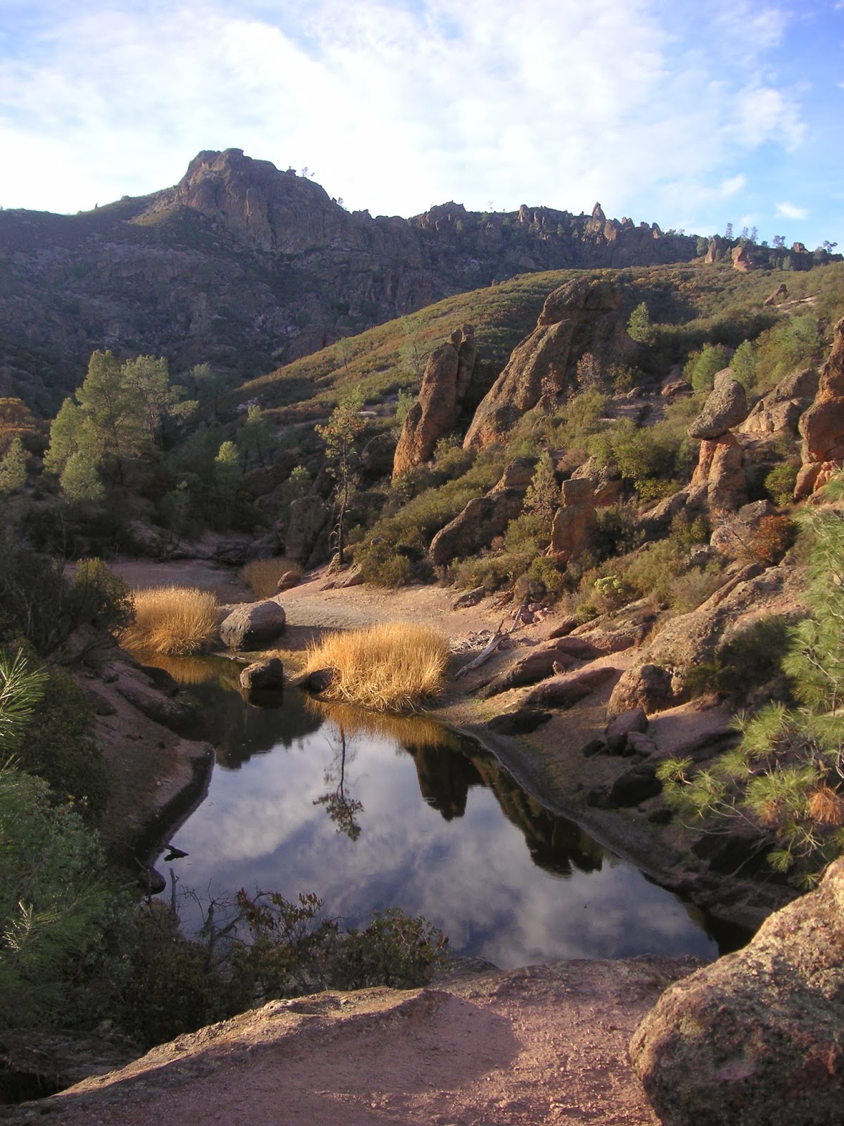
Bear Gulch Reservoir
Ahhh. It was so worth the long day of driving and hiking through the ick to get here, to this spot, to watch the shadows from the late afternoon sun, and to contemplate life.


