Showing posts with label * ponds. Show all posts

Wednesday, March 26, 2014

habitat ~ 03/26/14 ~ Ahwahnee Hills Regional Park


Here's another local gem we found while driving around, ostensibly in an attempt to find a restaurant that was actually open after our hike at Lewis Creek.  Since our stomachs insisted on being filled, we planned to return the next day.  Sure enough, plans?  Rain.  I guess I should be celebrating that my rain curse has returned.  Not to be deterred, Andy kindly served as my umbrella holder while I attempted to take pictures of flowers in the rain.

Ahwahnee Hills is less than 7 crow miles from and maybe 1000 feet lower in elevation than Lewis Creek.  It's a completely different type of habitat.  I appreciate the diversity.  Give a couple weeks, better lighting, and this place could offer great glamour shots for the spring months of any CA wall calendar.  Come to find out, Ahwahnee Hills only recently opened March 15, 2014 after 20 years of planning.  It's another public-private partnership, a trend I see more and more these days of little public money.  I had forgotten that federal parks closed temporarily last fall, including Yosemite, as this Sierra Star writer mentions in his review of Ahwahnee Hills.  I can totally see why people buy vacation property in the area.  It's a lovely place, even in the rain.

American beaver ~ 03/26/14 ~ Ahwahnee Hills


Oh?  Well, look at that!  Hey, there must be a beaver nearby!  We totally missed spotting the lodge, so we backtracked about a hundred yards to look around.

Is that the lodge?  It just looks like someone tossed a bunch of cleared brush down the bank.  That can't be it, no?  

Indeed, everywhere we walked at the newly opened Ahwahnee Hills Regional Park, there were numerous small piles of cut brush scattered about.  No wonder we didn't give this pile a second thought.  They were still grading the new trails, so I imagine there was plenty of path clearing involved.

Do you think they plan to burn the small piles?  We actually saw a couple yard waste fires along the roads from Bass Lake to Ahwahnee in the rain.  One fellow had such a high flame, I'm sure he used gasoline.  Even fires crews in the Sierra National Forrest were lighting fires. I didn't know burning yard waste was still a common practice due to concerns over air quality.  At least with the rain, there wasn't going to be much danger of a wildfire.  I'm guessing the area had a strict fire ban this record dry year.  Wildfires are hella scary.  They're supposedly good for CA ecosystems, but they wreck havoc on the human inhabitants.

So, I checked out the "brush pile".  Look at the angled gnaw marks on the twig end.  What surprised me was the patted down mud and the whole thing just leaning against the sloping bank.  While not reported for this end of Madera County, the CDFW states beavers in the Central Valley are primarily bank dwellers and often don't build lodges and dams.  I did not know that.  I wonder if this beaver may have caused trouble for humans elsewhere and was relocated to this handy-dandy new park where its activities will be encouraged.

I've seen evidence of beavers here and there over the years from CA to WA up to AK, usually just gnawed stumps.  The most I ever saw, including several actual animals, was when I backpacked the Adirondacks in NY.  They have crazy busy beavers back there with lodges and dams literally everywhere.  I bet our North American landscape would look so much different if beavers hadn't been trapped to near oblivion.  As it is, I'm glad to see they're still around.  Go, beavers!

Monday, March 10, 2014

habitat ~ 03/10/14 ~ Midpeninsula Regional Open Space District Preserve


Once again, a casual comment on Saturday led to another nature bloggers' get-together... at least, from my perspective.  For Ken @ Nature of a Man and Cindy @ Dipper Ranch this visit was work-related.  One of Ken's CNPS friends Paul also joined us on this hike around a closed MROSD Preserve.  My first impression?  This is not what I expected of the Santa Cruz Mountains.  It was wide open and sunny.  And quiet.  Remember, I live by the ocean with an almost constant backdrop of crashing waves.  Well, it wasn't entirely quiet up in the mountains. There was the incredible sound of wind through trees, speckled with extraordinary songs of birds, and the non-stop, excited chattering of nature nuts.  I say this with complete admiration for my companions.  I was just happy to tag along for the ride.  It was a gorgeous day.  I now have more IDs than I can shake a stick at.  More to come...

coast garter snake ~ 03/10/14 ~ Midpen Preserve

coast garter snake
Thamnophis elegans terrestris
(ssp. of western terrestrial garter snake)

I don't know how to sex snakes, but I'm calling it a she.  She was quick and sought refuge in the pond, but a long-legged herp fellow was quicker on his feet.  We thought the two red dots on her head were a nice addition to a very pretty little snake.

edited 04/01/14 - Thanks to Cindy's comment, I revised the ID from Santa Cruz garter snake (Thamnophis atratus atratus) to best guess a ssp. of the western terrestrial garter snake, the coast.  All 3 ssp. of aquatic garter snakes (T. atratus) do not have any red on their sides like this one clearly shows.  Doh! 

The other possibility would be one of the common garter snakes (T. sirtalis).  While Cindy says CA red-sided (T. sirtalis infernalis), I lean towards valley (T. sirtalis fitchi).  Look at this picture and tell me it doesn't look the same with that large eye and black wedges?  Well, okay, the individual shown above has 8 labial palps (typ. of western terrestrial, elegans), rather than only 7 (typ. of common, sirtalis), but that's apparently not 100% diagnostic.  Plus, neither T. sirtalis ssp. is supposed to be found in this area of the Santa Cruz Mountains, and we're confident, somehow, that this is not the endangered San Francisco garter snake (T. sirtalis tetrataenia). Confused, yet?  Join the club!

For a handy-dandy key to CA garter snakes, check out CA Herps.  And, for a brief summary of the confusion around garter snakes (with links) check out my CA red-sided post from Fort Ord.

CA newt ~ 03/10/14 ~ Midpen Preserve

Taricha torosa
Salamandridae

OK, what are they feeding the amphibians at this preserve?  Good golly, they're fat and huge, just like the Pacific chorus frog we found.   Seriously, no one is actively feeding these wild-found animals, but there must be plenty of food stuff available and plenty of comfortable habitat.  In one month's time, the CA newts have gone from skin and bones, like at nearby Stevens Creek on February 10, 2014, to fat, fat, fat.  Ya, the two locations have very different habitats, but still!  I'm unsure if the one in my hand is male or female.  Are those male nuptial pads on the toes?  Do you know?

a Rubenesque California newt

Wednesday, December 25, 2013

habitat ~ 12/25/13 ~ San Francisco Botanical Garden

December 25, 2013

We went up to San Francisco on Christmas again.  Get this, it didn't rain like 2012 and 2010.  It was gorgeous.  Of course, with beautiful, sunny weather, the people come out in droves, but I didn't mind too much.  The great thing we've discovered about rain is that it keeps many people indoors, which makes San Francisco feel like a totally different city.  This excursion may become a tradition for us - scenic drive up Hwy 1, House of Bagels, Botanical Garden, finding Le Soleil closed yet again and asking for recommendations from Clement St. locals, visiting with friends, and marveling at the Union Square hubbub.  It was a very good day.

Saturday, December 14, 2013

habitat ~ 12/14/13 ~ Frog Pond Wetland Preserve

Frog Pond Wetland Preserve
December 14, 2013

On our way out to get a steaming bowl of pho, Andy and I stopped at the Frog Pond for a quick walk around.  The air felt much warmer than the ice implies.  We rarely get frozen mud puddles near the coast, and the Frog Pond is less than 2 miles from Monterey Bay waters.  We've had trouble all over town with water pipes bursting under the roads and in buildings.  Although we've had near-freezing nighttime temps for a couple weeks, it wasn't until last week's rain that frost began to appear.  Yeah, it's been that dry.

There were lots of little birds scattered in the sunny pond area and in the willows. Three turkey vultures circled overhead.  And, we heard a red-tailed hawk cry in the distance. Per expected, we didn't see any dragons or damsels.  I have to say the Frog Pond is a very photogenic place.  My favorite photo set was back on January 7, 2012, when 'pond' meant more than a frozen mud puddle.

Sunday, September 29, 2013

habitat ~ 09/29/13 ~ Rocky Creek

Rocky Creek
September 27, 28, and 29, 2013

There was only a core group of 10 of us with 4 small dogs that camped this time.  The girlfriend invited her recently engaged friends, and I invited a fellow local blogger, Bread on the Water, and her husband down for a visit.  We had a bit less revelry than in the past, with no cocktail hour visitors and an evening honoring 2 of our friends who died recently.  Rocky Creek is a special place filled with fond memories.


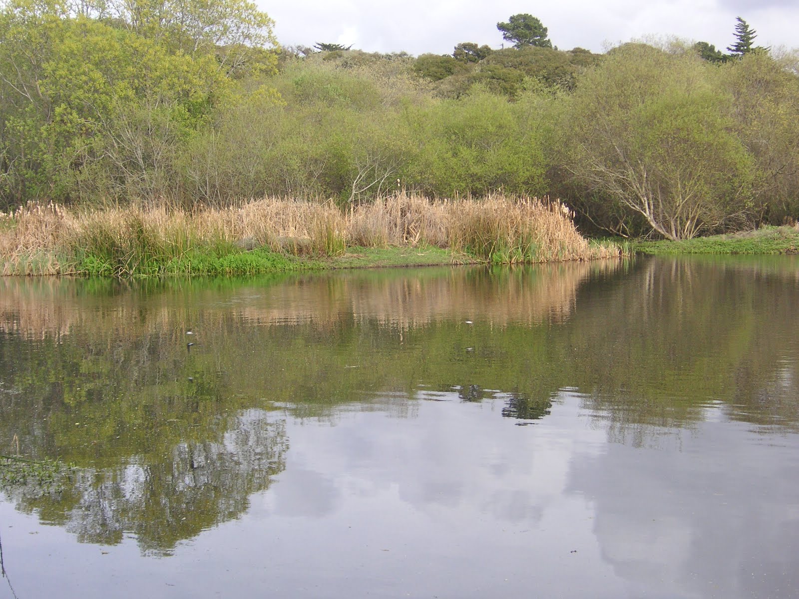
The pond was engineered by one of the family members who's a hydrologist.  The overflow goes right back into Rocky Creek.   There are several decent sized fish that jump around on occasion. 

I'm always amazed at the power of the wind to mold redwood trees into sculptural shapes.  And, yes, there always seems to be something in bloom, such as this silver bush lupine.


Here's what happens to tanbark oaks when Sudden Oak Death hits them.  SOD first started appearing in this canyon maybe about 10 years ago (?).  


And last, here's a view of Rocky Creek Bridge from the lower property road.  Caltrans is still working on repairing and upgrading a section of Hwy 1 just south of the Bridge that slid into the ocean 2 years ago.  BigSurKate has excellent updates on road closures there.

ps 10/22/13 - For a blog post about a recently released paper on SOD and redwoods, check out BigSurKate.

Monday, November 12, 2012

habitat ~ 11/12/12 ~ Frog Pond Wetland Preserve

November 12, 2012

When we walked down the steps from the newly fortified roadside parking area and looked toward the pond, our jaws dropped.  We have never seen the Frog Pond practically dried up. This year's drought has seriously taken its toll on local ponds and streams.  The shallow puddles that were present, perhaps from the previous week's rains, looked fairly recent with healthy land plants poking out and cracked mud.  The last picture above is from the middle of the pond area looking back at the dock where I usually take pictures of the water for past habitat posts (click and scroll down to see other posts). We had enough rain by this date that fresh green grass was starting to show along the trails.

Monday, May 28, 2012

habitat ~ 05/28/12 ~ Fort Ord National Monument

May 28, 2012

I've been going out to Fort Ord several times this month of May with various groups and guides. I hope to post more pictures from other outings, so keep an eye on the newest (backdated) entry section above if you don't subscribe to my blog.

This particular outing on Memorial Day was with Dr. David Styer, the 9+ year volunteer who has kept an impressive plant list and has an intimate knowledge of Fort Ord. He goes out every single day and walks a small section and records every blooming plant he sees. I first remember meeting him and his wife Jane on April 1 of this year when Andy and I happened to be out hiking. Apparently, they were both out on the same Army Lands tour that we took last year, but I don't remember particularly meeting them.

The first and last photos above are different views of Mudhen Lake. I questioned David about the difference between lakes and ponds. We talked about the varying temperature differences bottom to top for what qualifies as a lake or a pond. Considering the border plants, I personally view this water feature as a pond. He says a couple years ago this lake/pond dried up completely like a vernal pool. Go figure. For a prettier picture of Mudhen Lake when it had more water, take a look at the 4th  photo from the local BLM office site.

Mudhen Lake is significant for Dr. Styer and by extension Fort Ord National Monument. When I first met David, he told me how he "inherited" the original plant list from Charles "Chuck" Haugen. It was during a volunteer outing pulling invasive weeds when Chuck was stung several times by yellowjackets. He went into anaphylactic shock and died here at Mudhen Lake. David clearly remembers that day, because he was also pulling weeds and knew Chuck well. There is an interpretive sign in memoriam Chuck and his service, which I just posted. I wonder if Chuck was the last to die in service at Fort Ord. It was a good reminder of the more general meaning of Memorial Day.

Saturday, May 19, 2012

the Spirit of Service ~ 05/19/12 ~ Fort Ord National Monument

Charles "Chuck" Haugen

Mudhen Lake

Fort Ord National Monument
May 19, 2012

I took the opportunity right after this year's Fort Ord Army Lands tour (posts yet to come) to drive down Eucalyptus Road to Jacks Road, which were open to the public due to the dedication ceremony for the Fort Ord National Monument that was being held at the same time. I was too late for the ceremony, but it was nice to drive to a location that I have never hiked from the BLM Creekside entrance to Fort Ord. I talk about Chuck's significance for Dr. David Styer in another post from May 28, 2012.

Sunday, March 18, 2012

habitat ~ 03/18/12 ~ Frog Pond Wetland Preserve

March 18, 2012

The Frog Pond is a lovely quick jaunt outdoors that feels miles away from the trappings of town, even though this 17-acre natural spot sits in the middle of houses on three sides and a busy Hwy 218. One of the benefits of all those houses is that several have bird feeders in their backyards that abut the Preserve, which creates an amazing bird cacophony that drowns out the rumble of traffic. While I didn't find any dragons or damsels (Odonata) out yet, there were numerous tree swallows flying acrobatically over the pond. We also saw several coots and a few rusty-colored unidentified ducks, possibly cinnamon teals. Andy once spotted a bobcat here, so we always keep our eyes out for them, too. To see the Frog Pond through the seasons, check out my Frog Pond habitat label and scroll down.

As an aside, when I was checking to make sure the swallows we saw with bright white bellies and iridescent blue backs (the two white blurs over the pond in the second picture above) were indeed tree swallows and not barn swallows, I found this incredibly moving series of pictures from Taiwan. It's difficult not to anthropomorphize grief.

Saturday, January 7, 2012

habitat ~ 01/07/12 ~ Frog Pond Wetland Preserve

Frog Pond Wetland Preserve
January 7, 2012

Last week Graeme of Imperfect and Tense blog fame in the UK asked me if dragons and damsels were on the wing this time of year in my region. Hmm? The last time I remember seeing odonates was back on December 10, 2011 at Los Padres Dam, although I was unable to capture any pictures of them. Then, I realized I tend to notice when things are present, but I often neglect to consider what may be absent. This will be something I'll try to keep in mind this year.

As promised like a virtual hiker clear across the globe, off we went on a dragon and damsel hunt at the one local spot I felt sure would have them if they were indeed out in January. Normally, January can be quite stormy here, but so far we've have an extremely mild winter with barely a drop of rain mid-December. Sorry, Graeme, we had no luck in finding dragonflies or damselflies. However, I haven't given up, yet, and will keep my eyes peeled for them.

So often we don't feel like getting in the car on weekends, unless the promise of a good hike is in the offing. It was really nice to get out for a short hike a couple towns away (only 15 minutes by car) on a lazy Saturday when we probably would have taken a walk on the Rec Trail from home. The Frog Pond was the clearest I've ever seen it. There were coots, mallards, and various song birds, which made for a very soothing hike and a nice change of pace from the constant sound of crashing waves at home.

Monday, January 2, 2012

habitat ~ 01/02/12 ~ Palo Corona Regional Park


Palo Corona Regional Park
January 2, 2012

For the new year, we wanted to do a new hike. Heading south past Carmel, this is the first big hill one sees from Highway 1 before reaching Point Lobos. In the spring, the green is quite spectacular. I've wanted to frolic around these hills for the past 8 years, ever since I used to work on this side of the Peninsula and take walks during lunch. Through a complicated partnership, Palo Corona was acquired back in 2004, but it was only opened to the public this past year and with advanced permit reservation. Hmph! As I've mentioned before I'm adverse to planning hikes or camping trips in advance due to my typical rain curse. However, this winter season has been particularly dry, and we had overcast conditions with no rain for our reserved hike. While not very far as the crow flies from home, it was markedly windier and colder than at home in the shelter of the Monterey Peninsula on the Monterey Bay side.

The official MPRPD site (linked below the pictures above) is impressive, but it doesn't offer a decent statement of how limited the publicly accessible areas currently are. I found better information on the Big Sur Land Trust site, a new blog I found, and a series of Flickr photos. It's obvious there has been a ton of money dumped into this property, especially compared to our increasingly neglected State Parks. The mere couple miles of trail to Animas Pond (shown in the 4th pic above) are lavish and disturbingly odd with thick, freshly laid DG (decomposed granite, a popular trail covering in our area), more fancy schmancy benches and picnic tables than you can shake a stick at (with only 21 permits allowed per day, why would they need so many every 100 yards or so?), and not to mention the numerous signs and gates stating "not open to the public" or with complicated handicap loopy locks. The views of Carmel Bay (extends from Pebble Beach to Point Lobos) and the chichi Quail Lodge Golf Club are prominent once you get up the hill away from the many cows, which we had the pleasure of watching get fed hay from the back of a truck. I look forward to when more trails are opened.

Oh, I also saw my second bobcat! It hurried away before I could get my camera out of my pocket. Didn't I say now that I've seen one, I will see them all the time?

ps 02/07/12 - For a great video of what the hike to Inspiration Point (0.6 mile before Animas Pond) looks like, check out Walkifornia.