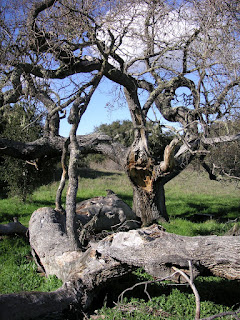


Garland Ranch Regional Park
February 20, 2011
February 20, 2011
So often Nature ID posts are of specific things, getting as close as my point-and-shoot will allow for a positive ID. However, I do like to take a step back and look at the larger picture. I hope I can convey in my habitat shots what any location is like throughout the year. While my blog is not a hiking blog (there are much better ones, like Way Points and Bay Area Hiker), I believe people may be able to get a sense of if and when they'd like to hike at the many locations shown here. All locations are labeled with an 'x' and grouped to the right of my blog towards the bottom.
In the 2nd picture above, there is indeed snow on the hill tops. To the left is the Sierra de Salinas range and to the right is the better known Santa Lucia Range. By Saturday after these pictures were taken, we had snow here at sea level along the Monterey Bay.
In the 2nd picture above, there is indeed snow on the hill tops. To the left is the Sierra de Salinas range and to the right is the better known Santa Lucia Range. By Saturday after these pictures were taken, we had snow here at sea level along the Monterey Bay.


