Showing posts with label * drought. Show all posts

Tuesday, July 8, 2014

habitat ~ 07/08/14 ~ Pinnacles National Park - west

Pinnacles National Park - west entrance
July 8, 2014

If you didn't know the date of this photograph, what season would you call this?  Maybe autumn with the deciduous buckeye trees?  Or typical CA summer?  No.  The season is drought.  Severe drought. Click to compare how this spot looked like back on April 22, 2014.  The National Weather Service recorded a temperature of 103°F by 2:37pm today, the hottest I've experienced in 3 months of my project.  It took a while to acclimate and figure out just how much water I really need to carry to be comfortable.  A wet shirt goes a long way in keeping cool.  Phew!

ps - 08/18/14 - I found Brent @ Breathing Treatment commentary about CA seasons to be relevant.

Tuesday, May 27, 2014

valley garter snake ~ 05/27/14 ~ Pinnacles

(ssp. of common garter snake)

The very few remaining puddles along the Juniper Canyon Trail creek are tightly confined hot spots for butterflies, bees and wasps, and this smallish valley garter snake!  It seems any small amount of water or moisture is coveted by wildlife this extremely dry year.   The following local nature cam trappers have done a fine job documenting the variety of activity:
Check 'em out!

ps 11/23/14 - And another Nature of a Man:  Hoping for Springs Eternal

Tuesday, February 25, 2014

habitat ~ 02/25/14 ~ Pinnacles National Park

February 25, 2014

Researching location labels for Nature ID has had an unforeseen benefit in that I'm now more appreciative of local parks.  I used to take them for granted.  Their ownership and management are not always the same entity and can change over time.  Pinnacles changed from a National Monument to a National Park on January 10, 2013 when President Barack Obama signed an act into law.  (Is this a different legal process than when he signed a proclamation on April 20, 2012 changing former Fort Ord Public Lands into a National Monument? I'm mildly curious to know how all this works.)  Eh, I've been griping about the lack of progress I see around me, e.g., this recent Hatton Canyon habitat post, yet I haven't given enough credit to the changes that have been made.

So, I've added a new location label for Pinnacles National Park.  I'm still undecided if I'll update my past National Monument labels.  For the record, they include:
west entrance location (habitat + IDs)
east entrance location (habitat + IDs)
all Pinnacles habitat
west habitat
east habitat

giant slalom section of the "butterfly highway"

I decided on this last-minute trip to Pinnacles hoping to find 2 specific butterflies before the week's heavy rains hit.  One was the margined white, which is not included in the Pinnacles Butterfly Checklist.  I queried Paul Johnson (it's his list) and Art Shapiro (my go-to CA butterfly expert) about why it might be missing, because there are plenty of milkmaids (host plant) at Pinnacles.  Paul's been looking for over a decade, but he admitted he's had doubts around some look-alike checkered and cabbages he's seen.  Art challenged me to go find them myself.  OK!  Considering I spotted margined at 2 very different locations in the past few weeks, I figured the sooner I get out to Pinnacles, the better chance I have at finding them, if they are there.  Nope.  It's dry.  Very dry.  Very few milkmaids are up yet.  And very few butterflies are out.  Without any clear photographic evidence, I spotted a red admiral, a couple mystery Vanessa ladies, a handful of echo blues, and...

large rocks covered with Dudleya (host plant) and Sedum

... a couple Sonoran blues.  Woohooo!  It's thanks to Ken @ Nature of a Man who sent me a recent picture of one to ID that I even remembered I've been wanting to get a picture of my own ever since Chris Grinter commented on my Dudleya post from 3 years ago.  I was so close to getting a good shot, but then I was afraid of falling off the rock.  You understand.

standard west entrance shot from the parking lot

As I debated whether I wanted to try another trail where I know more stonecrops grow, I marveled at the incredible palette Pinnacles provides even in this record dry winter we've had.  The iron red color of the buckwheats is starting to float my boat.  Given my relative lack of success, I wasn't so gung ho on butterflies anymore.  Plus, I was still feeling kinda icky and was a bit parched and craving the sight of water.  There are plenty of strenuous trails but no connecting roads through the park.  So, in an unusual move for me, I decided to drive over to the east entrance and hike to the reservoir. 

Bitterwater Road

The bleached out grey, died, dead was oppressive, and yet fascinating at the same time because it's so extreme.  I feel badly for the cows and the farmers.  Anyone else hoarding butter in their freezer like I am?  It's going to be worth its weight in gold.

Bear Gulch Reservoir

Ahhh.  It was so worth the long day of driving and hiking through the ick to get here, to this spot, to watch the shadows from the late afternoon sun, and to contemplate life.

Saturday, February 22, 2014

habitat ~ 02/22/14 ~ Fort Ord - BLM InterGarrison

 Fort Ord National Monument - InterGarrison entrance

Andy wanted to run some trails, and I tagged along for the ride.  I don't enjoy running like he does, so we often do our own thing.  We've gotten pretty good at setting a time limit and meeting up at the end.  He only wanted to do an 1 1/2 hour run, but I asked to push it to 2 hours (he's so accommodating to my whims) because I thought I'd have plenty of early spring sightings to keep me busy.  Nope.  Oh sure, under the oaks there's a gorgeous flush of green grasses and poison oak, as expected, but out in the wide open spaces...  

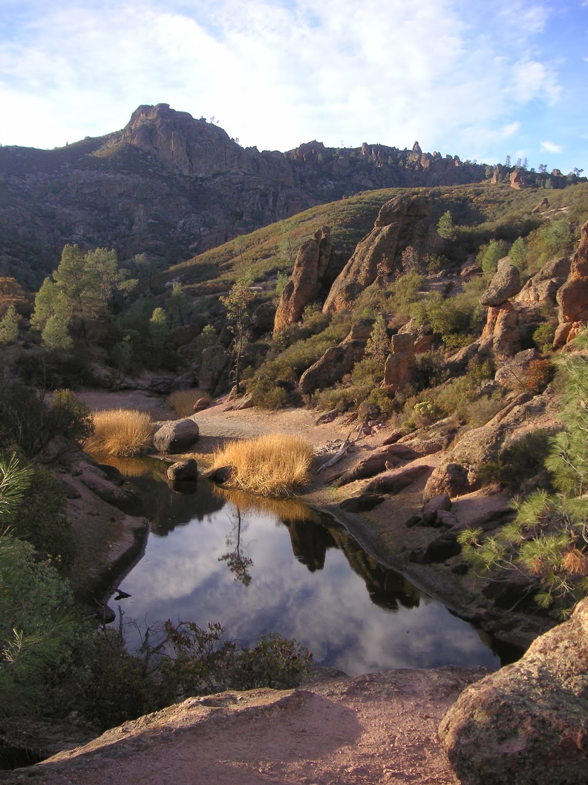
... grey, dried, dead.  This year's record-breaking drought has bleached the landscape into a flat monotone wash.  It doesn't even pretend to have the usual golden winter tinge.  Shown here is one of the larger vernal pool sites at Fort Ord.  Um, nope.  To compare how wet this spot can be, check out the 2nd picture from my habitat post taken March 20, 2011.

I headed directly to a road lined with large lilac trees (Ceanothus sp.), because I was hoping to see blooms considering the Ceanothus in gardens around town are going gangbusters right now.  Um, nope, again.  Grey.  Dried.  Dead?  In my head, I rationalized the moderate amount of rain 2 weeks ago was enough to kick things into gear.  It looks like it's going to take a lot more rain to catch up to what I expect.  I'm hoping this is not becoming the new normal.

So, I'll admit I've been in a bit of a foul mood lately, which may just be an annual February thing, but... Argh!  Seriously?  Once again there are new closed trail signs, this time "No Trespassing", and once again they're being promptly vandalized.  Many of the metal signs were completely ripped off their hefty posts and tossed into the poison oak.  In the summer of 2009, the BLM first started adding "closed trail" stickers to their brown trail markers, which were ripped out by May 2010.  Then sometime during the winter of 2011-2012, somebody added new "area closed" red markers, which were defaced immediately by February 2012.  I say "somebody", because I'm not sure if it was the BLM or the owners of the neighboring private property, who apparently host bicycling races as I discovered this day with all the traffic.  Was there a transfer of land somewhere in the last 5 years?  I don't know.  You gotta figure the signs are spendy to make and install, and I just don't see how vandalizing them is productive in any way. There's obviously a kerfuffle going on.  Look at the tire tracks behind the sign.  There you go.

Saturday, December 7, 2013

coast live oak ~ 12/07/13 ~ Fort Ord

Fagaceae

As we were driving out to the Creekside entrance on Hwy 68, I noticed most of the oaks had dead tips.  Speeding past, it looked like a deep green mosaic with scattered bits of tan.  I don't think this is sudden oak death, which is caused by a fungus-like pathogen.  I'm guessing it's caused by true fungal diseases, some of which apparently show themselves more when the oaks are drought-stressed, like this year.  I'm not quite sure how that works since fungi generally like moisture.  Right?  This looks very different from the swaths of entirely dead trees I saw last year at Toro Park, which is located right across the street of Hwy 68.  The U.S. Forest Service Pacific Southwest Research Station has an excellent technical report "A Field Guide to Insects and Diseases of California Oaks".  Maybe it's Diplodia quercina branch canker (pp. 88-89) or Cryptocline cinerescens twig blight (pp. 76-79)?  I really don't know.  I'm no tree doctor.  Half the time I can't even distinguish coast live oak from other Quercus spp.  In any case, this widespread dieback is interesting to note.

ps 03/12/14 - An intern from a local paper The Californian contacted me regarding this post.  She wants to use my pictures and information in an article she's writing.  This is the first time I've ever been contacted by a newspaper for Nature ID, so it was an interesting experience... I think for the both of us.  She was sweet but sounded a little nervous.  I gave my photos free of charge, because I didn't want the hassle of creating an invoice and dinging for payment (so many places conveniently "forget" to actually pay).  I'll link to the article once it comes out.  Cool beans.

Monday, November 12, 2012

habitat ~ 11/12/12 ~ Frog Pond Wetland Preserve

November 12, 2012

When we walked down the steps from the newly fortified roadside parking area and looked toward the pond, our jaws dropped.  We have never seen the Frog Pond practically dried up. This year's drought has seriously taken its toll on local ponds and streams.  The shallow puddles that were present, perhaps from the previous week's rains, looked fairly recent with healthy land plants poking out and cracked mud.  The last picture above is from the middle of the pond area looking back at the dock where I usually take pictures of the water for past habitat posts (click and scroll down to see other posts). We had enough rain by this date that fresh green grass was starting to show along the trails.