Showing posts with label * signs - warning. Show all posts

Saturday, May 19, 2012

habitat ~ 05/19/12 ~ Fort Ord - Army Lands

Fort Ord National Monument
Fort Ord - Army Lands
May 19, 2012

posted 06/04/12 - We took the same style Nature Walk of Fort Ord Army Lands' Impact Area, like we did last year on May 14, 2011. Once again for the 3rd year running, the U.S. Army's Fort Ord Community Relations Office coordinated this special access tour of publicly closed lands with the U.S. Army Fort Ord Base Realignment and Closure (BRAC) Field Office folks and their "intern" Bart from CSUMB's Coastal and Watershed Science & Policy M.S. program. They also enlisted several volunteers to help lead this year's very large group, including David Styer, his wife Jane, and Sean McStay, Steward of the Fort Ord Natural Reserve (part of the University of California Natural Reserve System). This year was unusual for last-minute coordination with the dedication ceremony of the Fort Ord National Monument, which was being held at the same time through some of the same access roads. I was very impressed with how Bruce Delgado (BLM) and Melissa Broadston (Community Relations) efficiently directed traffic to each event.

Before I write additional details, I should point out to any Nature ID readers that what is presented here comes from my notes of what I believe I heard (remember, I have a hearing impairment) and my own photos from the tour. For official information, visit the following sites: Former Fort Ord Environmental Cleanup (essentially BRAC), Bureau of Land Management (BLM) Hollister Field Office (site currently being updated extensively due to several new land designations), and Fort Ord Reuse Authority (FORA) (to be honest, I don't fully understand what they actually do, but I was eagerly offered a phone number from a fellow responsible for the habitat conservation plan for all non-National Monument areas - it's all being politicized and controversialized, so I'm hesitant to comment on it).

I was pleased to be remembered from last year and to hear from Gail Youngblood, BRAC's Environmental Coordinator, that their online cleanup site visits increased significantly coming from my blog (somehow they can track these kinds of things). She asked me to let people know there will be a free guided bus tour (read: safe and easy) on Saturday, June 23 for folks interested in Fort Ord munitions cleanup. I was also happy to see Chris Duymich, BRAC's Prescribed Burn Manager, who is very knowledgeable about the succession of Fort Ord plant species after fires and mechanical disturbances. She let Jane lead the plant IDs. Jane does not waste time. I also received an invitation from Sean, the local UC Steward, for a personal tour of adjacent land, for which I have yet to take him up on his offer.


types of ordnance found at Fort Ord

I've mentioned several times about UXOs at Fort Ord, both on closed Army Lands (the reason why it's taking so long to make lands available to the public) and BLM trails previously opened to the public (e.g., the last picture from this March 20, 2011 habitat post). I know absolutely nothing about explosive weapons, so I can't figure out how a 3 inch (<8 cm) anti-tank rifle grenade can be so large - my hand span from thumb to forefinger is 6 inches (~16 cm). I regularly see small bullets on the trails (e.g., the last picture from this June 30, 2011 habitat post) most often from the InterGarrison side of the BLM lands. I know some people who like to collect the bullets they find on the trails, which I consider rather peculiar. Seeing these massive weapons on display makes me definitely want to stay on designated open trails. Eh-hem, hello, mountain bike riders?


2006 burn area - Munitions Response Site (MRS) 16

Our tour route was a little different from last year's Nature Walk. The 2011 autumn burns (from home it would have looked like this October 8, 2010 burn) were cancelled due to the discovery of surface 155mm and 8 inch rounds (equivalent to 20 lbs. of ammunition in each - Holy Toledo!... or is that holy torpedo?) in the planned burn area. Obviously, there were safety concerns, especially with the potential travel distance of the thick metal casings of such massive explosives. I'm not sure how they're getting the rounds neutralized. As a result, we didn't tour a previous year fire area. I was slightly bummed, because I wanted to see fire poppies again. Although, David Styer told me that this spring he spotted a few fire poppies in a 2010 burn area, and they were all finished blooming by now.


2003 burn area - Units 43-48

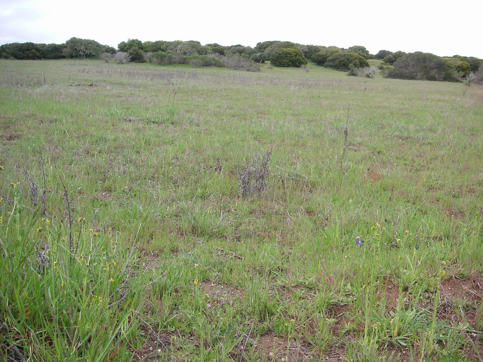
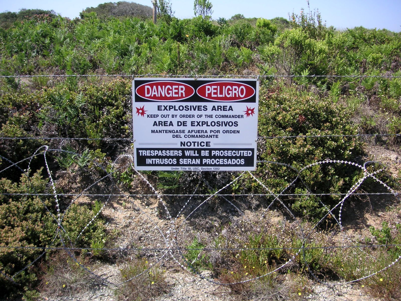
So, after seeing the ordnance display and knowing we were entering the razor fenced area shown in the first picture of this post (a 2008 Unit 18 burn area, which hasn't been completely cleared of UXOs), I was a little nervous about traversing this section of the tour. As you can see we had plenty of guides, including BRAC's munitions safety fellow Lyle. In the distance are the 2003 burn units, some of which are proposed to be made into commercial or residential areas. Like I said last year, this area is very sandy and can't be compared plant-wise with other units, although most of the rarer plants are here.


the bunker

I didn't get a close pic from last year, so here's one. This is not one of the bunkers that is shown on every PDF trail map of Fort Ord. The solar-powered, tall antenna is for GPS, which BRAC and contractors utilize extensively to map Impact Areas.


2009 burn area - Unit 19

In the first pic of this 2009 burn area, the line at the base of the sandy hills used to have train tracks for soldiers to practice shooting at moving targets. The second pic is to show what I believe could be a vernal pool in a transition area from sand to clay, the two predominant soil types found at Fort Ord.


2008 burn area - Unit 22

Here are pics to compare with last year's 2008 burn area (click photos 4, 8, and 9). Considering the lack of rain this winter, it's not as lush green and the vernal pool is completely dried. Interesting thing though, the flowers in bloom were pretty much the same, perhaps just not as many of them.

Sigh, this was a surprisingly difficult post for me to write. I took way too many notes with all my May tours of Fort Ord. Quite frankly, I'm Fort Orded and grouped out to the max. If I can find time and get back into ID mode, I hope to post individual IDs of new flowers (and animals) for Nature ID. Lately, I've simply been enjoying any time outdoors, alone and away from people, without notes, without camera, and without computers.

Sunday, October 2, 2011

habitat ~ 10/02/11 ~ Monarch Grove Sanctuary


I don't have any pictures of monarchs here. We saw maybe 5, mostly clustered on one lone pride of Madeira bloom. We were told by the ever-active volunteer Tama O. that the majority of monarchs don't actually arrive until mid-November. Many tourists are a bit disappointed to see so few monarchs now, even though most everything about the Sanctuary states the butterflies start arriving by October. A lot has changed in the park since we last visited.

The pride and joy of Pacific Grove has been surrounded by death and controversy. Back in 2004, an elderly tourist was killed here by a tree that broke during a wind storm, hence the sign. My question is why would anyone go out looking for butterflies during a storm? The City settled a wrongful death lawsuit for $1 million. Since then, the City has done extensive tree removal and pruning, which raised the hackles of some monarch enthusiasts. Through private donations and some City funds, new trees were purchased and improvements made to this small 2.4 acre park. For more information about the Monarch Grove Sanctuary, check out the Pacific Grove Monarch Conservancy.

Saturday, May 14, 2011

habitat ~ 05/14/11 ~ Fort Ord - Army Lands

Fort Ord - Army Lands
May 14, 2011

Thanks to the U.S. Army's Fort Ord Community Relations Office we joined a guided nature walk inside this non-public impact area (no pun intended). Eventually in 2020 this land will be turned over to the U.S. Department of the Interior's Bureau of Land Management (BLM) to expand the existing Public Lands to 15,000 acres. I've mentioned a couple times that the Fort Ord BLM Lands are my favorite local hiking spots (Creekside and Inter-Garrison), so it was exciting to get a glimpse of what will be.

I can't say I comprehend the process it takes to comply with all the laws and regulations, let alone the basic removal of potential explosives and lead contamination. There are so many entities involved and numerous websites; the best ones I've found are Fort Ord Reuse Authority (FORA) sites, old and new, and Former Fort Ord Environmental Cleanup. The Army's Munitions Clearance Program and Prescribed Burn Program are closely tied together, so I'll focus on the burn areas we toured.


the bunker

We were given a couple route options, and we chose the hike that led up to the bunker where the surrounding areas were burned in 2003 and 2008. While it was a quick pace to keep ahead of the more leisurely group behind us that did not hike up to the bunker, I'm glad we did.


2003 burn area

I suspect this area on top of the sandy hill was a different habitat type than those shown below. Therefore, looking at vegetative growth post-fire doesn't compare for the 2003 burn. Most of the endangered and threatened plant species we saw were found here.


2008 burn area

Shrubs, like silver bush lupine (Lupinus albifrons var. albifrons) and yellow bush lupine (Lupinus arboreus) have had enough time to grow back since 2008.


October 2009 burn area

This was the first year I was at home to see the smoke plume from home. I took a picture and made note of it here on Nature ID for October 6, 2009.


October 2010 burn area

Again, I took a picture of this particular 2010 burn from home and posted about it here on Nature ID for October 8, 2010. They also burned in September of 2010. I had expressed an interest to "tag along with the biology folks as they evaluate the September vs. October burn areas next spring." While I doubt a study like this is happening, I was so pleased to see fire poppies for the first time ever.


planned 2011 burn area in the distance

Yep, there'll be more fires through this decade until at least 2020. The first prescribed burn was conducted in 1997. Imagine over 20 years of regular fire, weather, and wildflower data?


vernal pool with soil excavation in 2008 burn area

The light green area in the center of both photos above is the same vernal pool from different vantage points. In the second photo, there's a wall to the right where soldiers trained to fire into the hill on the left. Due to accumulated munitions, the soil on the hill was excavated to sample and remove lead contamination.


"iron triangle"

As the cleanup process continues, various Army equipment used for target practice and heavier materials (and illegal dumping like the clothes dryer shown in the middle) get collected here in what is affectionately called the "iron triangle." A contractor will come in to recycle what can be recycled and haul off the rest... except for the Cold-War era tank 21 (last picture above), which will be kept as a historic display for the BLM. To read more about the history of Fort Ord, check out The California Military Museum's website.

Sunday, March 20, 2011

habitat ~ 03/20/11 ~ Fort Ord - BLM InterGarrison

Fort Ord Public Lands - InterGarrison entrance
March 20, 2011

Considering it had been raining for a solid week before this hike, and indeed during our hike, all the vernal pools we passed were filled. They look like lakes, but most of them do dry up by the end of summer. Many rare plants can be found around the vernal pools, including Hickman's popcorn flower, which we found completely submerged by the recent rains.


This is quite possibly the largest vernal pool at Fort Ord. It extends to about twice as wide as shown in the picture. The InterGarrison parking area, consisting of a sand lot with no facilities, is located straight as the crow flies to the left of the water tower and a bit beyond.


I took this photo to show how this particular meadow looks before the sky lupine really gets going. There is only one lone lupine blooming now with some fiddlenecks. For a comparison photo taken from almost the exact same spot, see my May 8, 2010 lupine post.


This photo is looking southeast over towards the Creekside entrance where the trails are a bit more established and erm, less dangerous...


And the last photo is a reminder that the BLM lands were once an Army training site. I didn't get a great shot of the sign, because I was more interested in the brush clearing they were doing of a trail that had been previously open. The sign says, "Danger. Do not enter. This area is being investigated for ordinance and explosives." I got on my soapbox and mentioned this in my star tulip post from this hike.

While I don't particularly like hiking in the rain, Andy convinced me to get out there with hopes to see the bobcat he spotted the day before during a trail run. We only saw some bobcat poop in the usual places. I have to say, I think Fort Ord is becoming my favorite local place to hike, even more than Garland Ranch Regional Park.

ps 05/12/12 - At the end of April, I was contacted by a California Stare University, San Jose student who is working on a group project regarding California coastal wetlands. Apparently, Fort Ord vernal pools was his assignment for a presentation. Since his photos from a March 8 personal tour were of very dry vernal pool areas, he used and credited my first 2 pictures above to show vernal pools at Fort Ord with actual water in them. It pleases me that students and university professors are finding my blog for first-hand accounts, which are not simply repeated blurbs found on so many sites.

Friday, May 28, 2010

grunion greeting, 2010 #3


Carmel Beach City Park
full moon cycle, 10:45-11:35pm, clear skies

To save you from having to read all this, we didn't see any grunion. No big surprise. This is a new grunion greeting beach for us; we figured researcher Liz and possibly Diane had Del Monte covered for the night. We looked for eggs here with Dr. Martin last year at the end of the northerly season (August, not July like in SoCal).

As you can tell by the first picture, there are almost no lights on the beach compared to Del Monte. The moon was all we had to help us look for grunion. Yep, we have a headlamp, but it's better to keep the eyes adjusted to the low lighting. It's funny how wrack suddenly becomes a potential animal in the dark. Since this is located around the peninsula on the ocean side, the waves are a little bigger and the air is saltier, not to mention we were discombobulated from the different location of the moon in relation to the beach. Interestingly enough, the high tide is listed as occurring 3 minutes earlier than at Del Monte.

Like I did with Seaside Beach last year, I'm including a picture of the warning signs. A tourist drowned here earlier this year in February from the sneaky rip currents. Fortunately, the waves were not out of control this night. I'm unwilling to check Carmel Beach during the pitch black of a new moon night.

Some people had a bonfire down the beach and were lighting off fireworks. Needless to say it was entertaining to watch while we were being skunked by the grunion. I don't think Monterey is on the official grunion greeting list this year. Indeed, last year was the first year for the program in our area. All my times listed above, now without parenthesis, show when we were out, versus previously posted times. As per Karen's request, I am still reporting my non-findings to the research program.

Oh! We did stop by Del Monte on our way home for about 15 minutes. No grunion and only a small group of high school girls taking pictures of each other. Guess it was too late to catch Liz, even though we made it home by midnight.

Monday, June 22, 2009

grunion greeting, 2009 #8

Seaside Beach
new moon (10:20-12:20), clear skies

The past 2 nights' late schedules have finally caught up with me. I'm still a little loopy as I edit this posting. We did not spot a single grunion at either Seaside or Del Monte beaches.

We reluctantly signed up online for Seaside Beach since a group was already scheduled to monitor our fave Del Monte Beach. Granted, we feel a bit of claim over Del Monte since we've been there every night plus since the monitoring project started in Monterey this year; but we also feel a responsibility to try to cover the beaches requested in the project.

The warning signs should have, um, well... warned us! Seaside Beach was hella scary!!!

The nondescript tan-black pic with spots above was a wave that ambushed us 20 yards from the wave break! The very steep berm reminded me too much of how the waves break at Mission Beach where several people have died in recent years. I love nature n' all, but it was too dangerous to be out looking for little grunion amongst humongous waves crashing all around us in the dark!

Here are the details:

10:05-10:25 north side of BW hotel. Per Charlie's lead, we headed out before the high tide. There was a massive hump of sand where if waves reached that point they went 30 yards over the downside. We spotted a dead sea lion with its head bitten clean off. I didn't take a pic of the grossness.

Took shelter at BW hotel. Mighty fine hotel and much nicer than it looks from the freeway. Since we live here we don't stay in local hotels, but people always seem to ask me for recommendations.

10:30-11:05 from BW hotel balcony, we observed south and north sides of beach. The south side above was slightly calmer than the north side. Nothing to note save for some wrack and a 3-4 ft. dead silvery fish being tossed around in the waves. Am guessing it was a dead tuna. We found it hard to believe grunion would be spawning in such harsh waters, so we left.

11:15-11:50 not wanting to miss out, we arrived at Del Monte Beach near the volleyball courts. The water was very calm compared to Seaside. We walked to the cement structure and back towards the pier. Met up with Diane and her group, exchanged a few words, looked around, and walked back to the car. NOTHING. One point to note, by an hour after high tide, the water level was still past any previous high tides we've witnessed before (i.e. 6th and 7th parking meters from the bathrooms). The last picture above shows the water level came all the way up level with the bathrooms.

Phooey! I wanted to see a W-3!